
Carte topographique Thakhek District
Carte interactive
Cliquez sur la carte pour afficher l’altitude.
À propos de cette carte
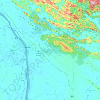
Nom : Carte topographique Thakhek District, altitude, relief.
Lieu : Thakhek District, Khammouane, 12000, Laos (17.17113 104.65316 17.59668 105.01370)
Altitude moyenne : 214 m
Altitude minimum : 133 m
Altitude maximum : 896 m
Autres cartes topographiques
Cliquez sur une carte pour visualiser sa topographie, son altitude et son relief.
Ban Thap
Laos > Khammouane > Sebangphay District
Ban Thap, Sebangphay District, Khammouane, Laos
Altitude moyenne : 150 m
Ban Soy
Laos > Khammouane > Boualapha District
Ban Soy, Boualapha District, Khammouane, Laos
Altitude moyenne : 209 m