
Carte topographique Village of Valley Stream
Carte interactive
Cliquez sur la carte pour afficher l’altitude.
À propos de cette carte
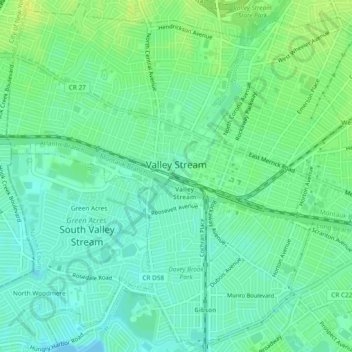
Nom : Carte topographique Village of Valley Stream, altitude, relief.
Altitude moyenne : 7 m
Altitude minimum : -4 m
Altitude maximum : 15 m
Autres cartes topographiques
Cliquez sur une carte pour visualiser sa topographie, son altitude et son relief.
Village of Laurel Hollow
Estados Unidos da América > Nova Iorque > Nassau County
Village of Laurel Hollow, Town of Oyster Bay, Nassau County, Nova Iorque, Estados Unidos da América
Altitude moyenne : 46 m