
Carte topographique Fort Clinton
Carte interactive
Cliquez sur la carte pour afficher l’altitude.
À propos de cette carte
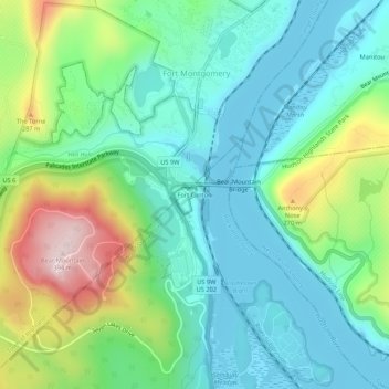
Nom : Carte topographique Fort Clinton, altitude, relief.
Altitude moyenne : 111 m
Altitude minimum : -1 m
Altitude maximum : 394 m
Autres cartes topographiques
Cliquez sur une carte pour visualiser sa topographie, son altitude et son relief.
Buckberg
United States > New York > Rockland County > Town of Stony Point
Buckberg, Town of Stony Point, Rockland County, New York, 10986, United States
Altitude moyenne : 108 m