
Carte topographique Reuth
Cliquez sur la carte pour afficher l’altitude.
Reuth
Das Pfarrdorf in der naturräumlichen Landschaftseinheit des Regnitztals liegt etwa vier Kilometer östlich des Ortszentrums von Forchheim auf einer Höhe von 332 m ü. NHN und ist mit dem Siedlungsgebiet von Forchheim zusammengewachsen.
À propos de cette carte
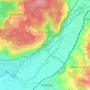
Nom : Carte topographique Reuth, altitude, relief.
Altitude moyenne : 304 m
Altitude minimum : 260 m
Altitude maximum : 370 m