
Carte topographique Center Point
Cliquez sur la carte pour afficher l’altitude.
À propos de cette carte
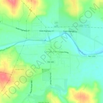
Nom : Carte topographique Center Point, altitude, relief.
Lieu : Center Point, Kerr County, Texas, United States (29.92226 -99.05688 29.96226 -99.01688)
Altitude moyenne : 471 m
Altitude minimum : 446 m
Altitude maximum : 519 m
Autres cartes topographiques
Cliquez sur une carte pour visualiser sa topographie, son altitude et son relief.
Kerrville
United States > Texas > Kerr County
Kerrville is characterized by a diverse and rugged topography. Nestled along the Guadalupe River, it sits at an elevation averaging 1,600 feet above sea level, with varying terrain that includes gentle hills, steep slopes, and flat river valleys. This area features numerous limestone hills, characteristic of…
Altitude moyenne : 545 m