
Carte topographique Bir
Cliquez sur la carte pour afficher l’altitude.
Bir
The paragliding launch site is in the meadow at Billing (14 km north of Bir), at an elevation of 2400 meters, while the landing site and most tourist accommodations are in the village of Chowgan (also spelled Chaugan), on the southern edge of Bir.
À propos de cette carte
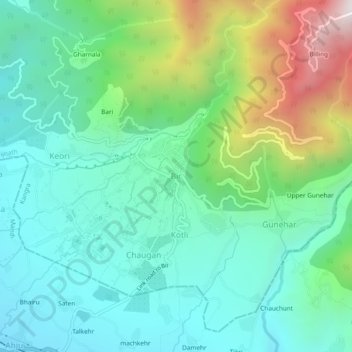
Nom : Carte topographique Bir, altitude, relief.
Lieu : Bir, Baijnath, Kangra, Himachal Pradesh, 176077, India (32.02452 76.70551 32.06452 76.74551)
Altitude moyenne : 1’628 m
Altitude minimum : 1’284 m
Altitude maximum : 2’560 m