
Carte topographique A Baña
Carte interactive
Cliquez sur la carte pour afficher l’altitude.
À propos de cette carte
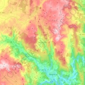
Nom : Carte topographique A Baña, altitude, relief.
Lieu : A Baña, A Barcala, A Coruña, Galicia, 15863, Spain (42.91627 -8.84152 43.00686 -8.65624)
Altitude moyenne : 325 m
Altitude minimum : 128 m
Altitude maximum : 516 m
Vesía is a town situated near the centre of the A Baña municipality, in the A Coruña province. It is part of the parish of San Vicente, the capital of the municipality. Vesía is at an altitude of 317.6 meters above sea level, and stands at an incline of 20.89%. Vesía has a population of around 40 people, the majority of whom are between 65 and 80 years old as the area has suffered youth emigration.
Autres cartes topographiques
Cliquez sur une carte pour visualiser sa topographie, son altitude et son relief.