
Carte topographique Chapel Hill
Carte interactive
Cliquez sur la carte pour afficher l’altitude.
À propos de cette carte
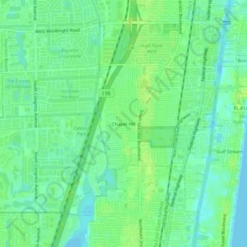
Nom : Carte topographique Chapel Hill, altitude, relief.
Altitude moyenne : 7 m
Altitude minimum : 0 m
Altitude maximum : 14 m
Autres cartes topographiques
Cliquez sur une carte pour visualiser sa topographie, son altitude et son relief.
Pence Park
United States > Florida > Palm Beach County > Boynton Beach
Pence Park, Boynton Beach, Palm Beach County, Florida, United States
Altitude moyenne : 7 m