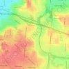
Carte topographique Centerville
Cliquez sur la carte pour afficher l’altitude.
Centerville
In 1913, Centerville sustained minimal damage during the Great Flood of 1913 due to its relatively high elevation. The city sits on one of the highest points in Montgomery County.
À propos de cette carte

Nom : Carte topographique Centerville, altitude, relief.
Lieu : Centerville, Montgomery County, Ohio, United States (39.59062 -84.20869 39.67385 -84.09909)
Altitude moyenne : 287 m
Altitude minimum : 226 m
Altitude maximum : 323 m
Autres cartes topographiques
Cliquez sur une carte pour visualiser sa topographie, son altitude et son relief.