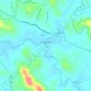
Carte topographique Muvattupuzha
Cliquez sur la carte pour afficher l’altitude.
Muvattupuzha
The town and western parts of the region are mainly plains and is culturally similar to Ernakulam, whereas the eastern parts are mainly highlands. The regions of Thodupuzha, Muvattupuzha, and Kothamangalam are called sub-high ranges or keezhmalanad of Vadakkumkoor Kingdom, indicating they were lands with fertile soil deposited by the Thodupuzha and Muvattupuzha rivers from flooding. Muvattupuzha and nearby areas are less hilly and fertile. The altitude is lower and the hilly region is the Kadalikkad-Meenkunnam-Pampakkuda curved region. The town is 20 m (66 ft) above mean sea level.
À propos de cette carte

Nom : Carte topographique Muvattupuzha, altitude, relief.
Lieu : Muvattupuzha, Ernakulam, Kerala, 686661, India (9.94315 76.53816 10.02315 76.61816)
Altitude moyenne : 28 m
Altitude minimum : 5 m
Altitude maximum : 94 m
Autres cartes topographiques
Cliquez sur une carte pour visualiser sa topographie, son altitude et son relief.