
Carte topographique Soldiers Delight Natural Environment Area
Carte interactive
Cliquez sur la carte pour afficher l’altitude.
À propos de cette carte
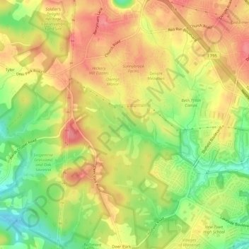
Nom : Carte topographique Soldiers Delight Natural Environment Area, altitude, relief.
Altitude moyenne : 187 m
Altitude minimum : 141 m
Altitude maximum : 221 m
Autres cartes topographiques
Cliquez sur une carte pour visualiser sa topographie, son altitude et son relief.
Owings Mills
United States > Maryland > Baltimore County > Owings Mills
Owings Mills, Baltimore County, Maryland, 21117, United States
Altitude moyenne : 173 m