
Carte topographique Hayman Park
Carte interactive
Cliquez sur la carte pour afficher l’altitude.
À propos de cette carte
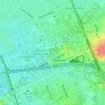
Nom : Carte topographique Hayman Park, altitude, relief.
Altitude moyenne : 29 m
Altitude minimum : 12 m
Altitude maximum : 74 m
Autres cartes topographiques
Cliquez sur une carte pour visualiser sa topographie, son altitude et son relief.
Manukau Sports Bowl
New Zealand > Auckland > Otara-Papatoetoe
Manukau Sports Bowl, Clover Park, Otara-Papatoetoe, Auckland, New Zealand
Altitude moyenne : 36 m