
Carte topographique Jaljala
Carte interactive
Cliquez sur la carte pour afficher l’altitude.
À propos de cette carte
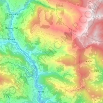
Nom : Carte topographique Jaljala, altitude, relief.
Lieu : Jaljala, Parbat, Gandaki Pradesh, Nepal (28.26725 83.56532 28.39185 83.66284)
Altitude moyenne : 1’816 m
Altitude minimum : 748 m
Altitude maximum : 3’301 m
Autres cartes topographiques
Cliquez sur une carte pour visualiser sa topographie, son altitude et son relief.