
Carte topographique Oldtown
Carte interactive
Cliquez sur la carte pour afficher l’altitude.
À propos de cette carte
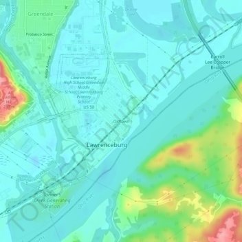
Nom : Carte topographique Oldtown, altitude, relief.
Altitude moyenne : 156 m
Altitude minimum : 134 m
Altitude maximum : 239 m
Autres cartes topographiques
Cliquez sur une carte pour visualiser sa topographie, son altitude et son relief.
Upland
United States > Indiana > Dearborn County > Lawrenceburg
Upland, Lawrenceburg, Lawrenceburg Township, Dearborn County, Indiana, 47025, United States
Altitude moyenne : 219 m