

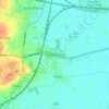
Carte topographique Hovingham
Cliquez sur la carte pour afficher l’altitude.
Hovingham
The nearest settlements are Slingsby 1.75 miles (2.82 km) to the east; Stonegrave 1.6 miles (2.6 km) to the north; Cawton 1.9 miles (3.1 km) to the north-west; Coulton 2.2 miles (3.5 km) to the west south-west and Scackleton 2.1 miles (3.4 km) to the south-west. The village lies at an elevation of 215 feet (66 m) at its highest point and is on the B1257 Malton to Stokesley road. Marrs Beck flows northwards through the village to eventually join the River Rye near Butterwick and Brawby.
À propos de cette carte

Nom : Carte topographique Hovingham, altitude, relief.
Altitude moyenne : 61 m
Altitude minimum : 25 m
Altitude maximum : 138 m
Autres cartes topographiques
Cliquez sur une carte pour visualiser sa topographie, son altitude et son relief.



Farndale
United Kingdom > England > North Yorkshire > Ryedale > Gillamoor
With the population having decreased greatly from the 668 that is recorded in "A Topographical Dictionary of Yorkshire" by Thomas Lansdale published in 1822 when farndale East side had a population of 455 and Farndale West Side had a Population of 213.
Altitude moyenne : 273 m














Bolton Castle
United Kingdom > England > North Yorkshire > Redmire > Castle Bolton
Altitude moyenne : 250 m


Thimbleby & Osmotherly Show field
United Kingdom > England > North Yorkshire > Thimbleby
Altitude moyenne : 152 m







Killinghall
United Kingdom > England > North Yorkshire > Harrogate > Killinghall
Altitude moyenne : 86 m



Ribblesdale
United Kingdom > England > North Yorkshire > Horton in Ribblesdale
Altitude moyenne : 368 m

Willerby Brow Plantation
United Kingdom > England > North Yorkshire > Ryedale > Staxton > Binnington
Altitude moyenne : 100 m

Howgill
United Kingdom > England > North Yorkshire > Craven > Appletreewick > Howgill
Altitude moyenne : 257 m