
Carte topographique Jorhat
Carte interactive
Cliquez sur la carte pour afficher l’altitude.
À propos de cette carte
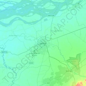
Nom : Carte topographique Jorhat, altitude, relief.
Lieu : Jorhat, Jorhat East, Jorhat District, Assam, 785001, India (26.59779 94.04796 26.91779 94.36796)
Altitude moyenne : 93 m
Altitude minimum : 74 m
Altitude maximum : 242 m
Jorhat is located at 26°45′N 94°13′E / 26.75°N 94.22°E / 26.75; 94.22. It has an average elevation of 116 metres (381 feet).