
Carte topographique Thatcham
Carte interactive
Cliquez sur la carte pour afficher l’altitude.
À propos de cette carte
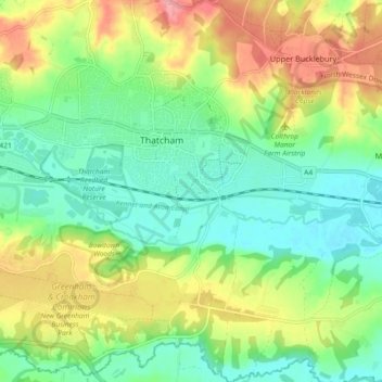
Nom : Carte topographique Thatcham, altitude, relief.
Lieu : Thatcham, West Berkshire, England, United Kingdom (51.36623 -1.29598 51.42332 -1.20907)
Altitude moyenne : 94 m
Altitude minimum : 58 m
Altitude maximum : 152 m
Autres cartes topographiques
Cliquez sur une carte pour visualiser sa topographie, son altitude et son relief.
Crookham Common
United Kingdom > England > West Berkshire > Thatcham
Crookham Common, Thatcham, West Berkshire, England, RG19 8DD, United Kingdom
Altitude moyenne : 98 m