Géolocaliser

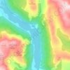
Carte topographique Ben More

Cliquez sur la carte pour afficher l’altitude.

Ben More

On 19 January 1973, a Vickers Viscount of British European Airways took off from Glasgow International Airport at about 14:20 on a test flight to be conducted at Flight Level (FL) 40; in the conditions prevailing at the time FL40 was equivalent to about 3,850 feet (1,173 m). At about 14:32 the aircraft flew into Ben More about 600 ft (180 m) northeast and 100 ft (30 m) below the summit while flying in a westerly direction. The two pilots and two passengers on board were killed in the accident. The Air Accidents Investigation Branch (AAIB) found that the aircraft struck Ben More whilst flying over snow-covered high terrain in marginal visual meteorological conditions and said that "Failure to maintain a safe altitude and insufficient attention to navigational procedures were contributory factors".

Wikipedia (CC-BY-SA 3.0)

À propos de cette carte

Nom : Carte topographique Ben More, altitude, relief.

Lieu : Ben More, Stirling, Scotland, United Kingdom (56.38596 -4.54011 56.38606 -4.54001)

Altitude moyenne : 698 m

Altitude minimum : 204 m

Altitude maximum : 1’169 m

Autres cartes topographiques

Cliquez sur une carte pour visualiser sa topographie, son altitude et son relief.

Loch Ard

United Kingdom > Scotland > Stirling

Altitude moyenne : 154 m

Achray Water

United Kingdom > Scotland > Stirling

Altitude moyenne : 167 m

Loch Ardinning

United Kingdom > Scotland > Stirling > Mugdock

Altitude moyenne : 136 m

Loch Lomond

United Kingdom > Scotland > Stirling > Balmaha

Altitude moyenne : 240 m

Loch Lomond and The Trossachs National Park

United Kingdom > Scotland > Stirling

The park straddles the Highland Boundary Fault, which divides it into two distinct regions - lowland and highland - that differ in underlying geology, soil types and topography. The change in rock type can most clearly be seen at Loch Lomond itself, as the fault runs across the islands of Inchmurrin, Creinch,…

Altitude moyenne : 291 m

Loch Katrine

United Kingdom > Scotland > Stirling

Altitude moyenne : 349 m

Killin

United Kingdom > Scotland > Stirling

Altitude moyenne : 174 m

Lake of Menteith

United Kingdom > Scotland > Stirling

Altitude moyenne : 31 m

Loch Chon

United Kingdom > Scotland > Stirling

Altitude moyenne : 242 m

Loch Doine

United Kingdom > Scotland > Stirling

Altitude moyenne : 301 m

Loch Earn

United Kingdom > Scotland > Stirling > Lochearnhead

Altitude moyenne : 393 m

Doune

United Kingdom > Scotland > Stirling

Altitude moyenne : 48 m

Campsie Fells

United Kingdom > Scotland > Stirling

Altitude moyenne : 156 m

Killin

United Kingdom > Scotland > Stirling

Altitude moyenne : 170 m

Glen Ogle

United Kingdom > Scotland > Stirling > Lochearnhead

Altitude moyenne : 463 m

Duchray Water

United Kingdom > Scotland > Stirling

Altitude moyenne : 212 m

Loch Venachar

United Kingdom > Scotland > Stirling

Altitude moyenne : 219 m

Loch Lubnaig

United Kingdom > Scotland > Stirling

Altitude moyenne : 382 m

Callander

United Kingdom > Scotland > Stirling

Altitude moyenne : 125 m

Loch Voil

United Kingdom > Scotland > Stirling > Balquhidder

Altitude moyenne : 370 m

River Teith

United Kingdom > Scotland > Stirling > Callander

Altitude moyenne : 96 m

Loch Arklet

United Kingdom > Scotland > Stirling

Altitude moyenne : 311 m

Loch Venachar

United Kingdom > Scotland > Stirling

Altitude moyenne : 219 m

Callander

United Kingdom > Scotland > Stirling

Altitude moyenne : 125 m

Callander

United Kingdom > Scotland > Stirling

Altitude moyenne : 125 m

Loch Lubnaig

United Kingdom > Scotland > Stirling

Altitude moyenne : 382 m

Abbey Craig

United Kingdom > Scotland > Stirling > Stirling

Altitude moyenne : 16 m

Loch Voil

United Kingdom > Scotland > Stirling > Balquhidder

Altitude moyenne : 370 m

Équipez-vous pour votre prochaine aventure :

🕶️Lunettes de glacier - Protection maximale contre les rayons UV intenses sur la neige
🔥Réchauds de camping - Réchauds compacts pour cuisine outdoor
🪖Casques vélo et VTT - Protection en terrain accidenté
🧥Veste coupe-vent - Protection légère contre les courants d'air sur les crêtes
🧴Crèmes solaires haute protection - Protection UV renforcée

En tant que Partenaire Amazon, ce site perçoit une commission sur les achats éligibles sans surcoût pour vous.