

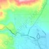
Carte topographique Fredonyer Pass
Cliquez sur la carte pour afficher l’altitude.
Fredonyer Pass
Fredonyer Pass, elevation 5,751 feet (1,753 m), is a high mountain pass in Lassen County, California, southwest of Susanville and southeast of Mount Lassen. It lies on the Great Basin Divide between the Feather River to the west and the Susan River and Honey Lake to the east.
À propos de cette carte

Nom : Carte topographique Fredonyer Pass, altitude, relief.
Lieu : Fredonyer Pass, Lassen County, California, United States (40.35996 -120.86647 40.36006 -120.86637)
Altitude moyenne : 1’749 m
Altitude minimum : 1’609 m
Altitude maximum : 1’929 m
Autres cartes topographiques
Cliquez sur une carte pour visualiser sa topographie, son altitude et son relief.
Susanville
United States > California > Lassen County
Susanville (formerly known as Rooptown) is a town in and is the county seat of Lassen County, California, United States. Susanville is located on the Susan River in the southern part of the county, at an elevation of 4,186 feet (1,276 m). Its population is 16,728 as of the 2020 census, down from 17,947 from…
Altitude moyenne : 1’345 m

Westwood
United States > California > Lassen County
Westwood is a census-designated place (CDP) in Lassen County, California, United States. Westwood is located 20 miles (32 km) west-southwest of Susanville, at an elevation of 5,128 feet (1,563 m). Its population is 1,541 as of the 2020 census, down from 1,647 from the 2010 census..
Altitude moyenne : 1’577 m

