
Carte topographique Independence Peak
Carte interactive
Cliquez sur la carte pour afficher l’altitude.
À propos de cette carte
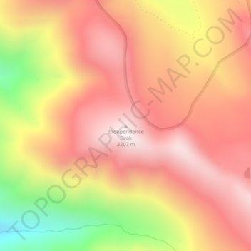
Nom : Carte topographique Independence Peak, altitude, relief.
Lieu : Independence Peak, Lincoln County, Montana, USA (48.95908 -114.96688 48.95918 -114.96678)
Altitude moyenne : 1’895 m
Altitude minimum : 1’318 m
Altitude maximum : 2’235 m
Autres cartes topographiques
Cliquez sur une carte pour visualiser sa topographie, son altitude et son relief.
Sundance Glacier
Sundance Glacier, Carbon County, Montana, USA
Altitude moyenne : 3’488 m
Crazy Mountains Historical Marker
Crazy Mountains Historical Marker, Wheatland County, Montana, USA
Altitude moyenne : 1’315 m
Grasshopper Glacier
Grasshopper Glacier, Carbon County, Montana, USA
Altitude moyenne : 3’407 m
Miche Wabun Glacier
Miche Wabun Glacier, Goat Haunt Overlook, Glacier County, Montana, USA
Altitude moyenne : 2’177 m
Two Ocean Glacier
Two Ocean Glacier, Logging Lake, Flathead County, Montana, USA
Altitude moyenne : 2’331 m
Phantom Glacier
Phantom Glacier, Clarks Fork Trail, Carbon County, Montana, USA
Altitude moyenne : 3’248 m
Pryor Mountains Historical Marker
USA > Montana > Berts Trailer Court
Pryor Mountains Historical Marker, Berts Trailer Court, Carbon County, Montana, USA
Altitude moyenne : 1’097 m
Blacktail Mountains
Blacktail Mountains, Beaverhead County, Montana, USA
Altitude moyenne : 2’697 m
Jackson Peak
Jackson Peak, Lewis and Clark County, Montana, USA
Altitude moyenne : 1’271 m
Lupfer Glacier
Lupfer Glacier, Coal Creek, Flathead County, Montana, USA
Altitude moyenne : 2’047 m
Carter Glaciers
Carter Glaciers, Flathead County, Montana, USA
Altitude moyenne : 2’099 m
Blackfoot Glacier
Blackfoot Glacier, Jackson Glacier, Glacier County, Montana, USA
Altitude moyenne : 2’286 m
Harris Glacier
USA > Montana > Wurtz Hill
Harris Glacier, Boulder Pass, Wurtz Hill, Flathead County, Montana, USA
Altitude moyenne : 2’138 m
Ahern Glacier
Ahern Glacier, Highline Trail, Flathead County, Montana, USA
Altitude moyenne : 2’214 m
Fortress Mountain
Fortress Mountain, Gallatin County, Montana, USA
Altitude moyenne : 2’688 m
Siyeh Glacier
Siyeh Glacier, Piegan Pass Trail, Glacier County, Montana, USA
Altitude moyenne : 2’341 m
Gem Glacier
Gem Glacier, Highline Trail, Flathead County, Montana, USA
Altitude moyenne : 2’150 m
Devils Slide
Devils Slide, Many Glacier Road, Babb, Glacier County, Montana, 59411, USA
Altitude moyenne : 1’502 m
Thunderbird Glacier
USA > Montana > Wurtz Hill
Thunderbird Glacier, Boulder Pass, Wurtz Hill, Flathead County, Montana, USA
Altitude moyenne : 2’162 m
Pumpelly Glacier
Pumpelly Glacier, Jackson Glacier, Glacier County, Montana, USA
Altitude moyenne : 2’326 m
Baby Glacier
Baby Glacier, Bowman Lake, Flathead County, Montana, USA
Altitude moyenne : 2’009 m
Ipasha Glacier
Ipasha Glacier, Highline Trail, Flathead County, Montana, USA
Altitude moyenne : 2’122 m
Old Sun Glacier
Old Sun Glacier, Stoney Indian Pass, Glacier County, Montana, USA
Altitude moyenne : 2’285 m
Weasel Collar Glacier
Weasel Collar Glacier, Bowman Lake, Flathead County, Montana, USA
Altitude moyenne : 2’290 m
Sperry Glacier
Sperry Glacier, Sperry Lake, Flathead County, Montana, USA
Altitude moyenne : 2’382 m
Rainbow Glacier
Rainbow Glacier, Bowman Lake, Flathead County, Montana, USA
Altitude moyenne : 2’400 m
North Swiftcurrent Glacier
North Swiftcurrent Glacier, Swiftcurrent Lookout Trail, Flathead County, Montana, USA
Altitude moyenne : 2’051 m
Red Eagle Glacier
Red Eagle Glacier, Nyack Creek, Nyack, Flathead County, Montana, USA
Altitude moyenne : 2’100 m
Salamander Glacier
Salamander Glacier, Garden Wall Trail, Flathead County, Montana, USA
Altitude moyenne : 2’102 m
Hudson Glacier
USA > Montana > Wurtz Hill
Hudson Glacier, Boulder Pass, Wurtz Hill, Flathead County, Montana, USA
Altitude moyenne : 2’079 m
Swiftcurrent Glacier
Swiftcurrent Glacier, Garden Wall Trail, Flathead County, Montana, USA
Altitude moyenne : 2’062 m