
Carte topographique Mount Davis
Carte interactive
Cliquez sur la carte pour afficher l’altitude.
Mount Davis
Mount Davis has a humid continental climate that is affected by the high elevation significantly enough that the area feels slightly more like a cooler version of the climate zone during the winter months. Due to its high elevation, the area is colder much of the winter than Altoona, Johnstown, or State College, despite being well south of those locations. During the summer months, the area is a retreat for other Pennsylvanians with high temperatures averaging around 15 degrees cooler than Pittsburgh and eastern portions of the state. Mount Davis recorded many impressive record lows and is quite close to the state's all-time coldest temperature.
À propos de cette carte
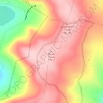
Nom : Carte topographique Mount Davis, altitude, relief.
Altitude moyenne : 906 m
Altitude minimum : 778 m
Altitude maximum : 975 m