
Carte topographique Broadmoor
Carte interactive
Cliquez sur la carte pour afficher l’altitude.
À propos de cette carte
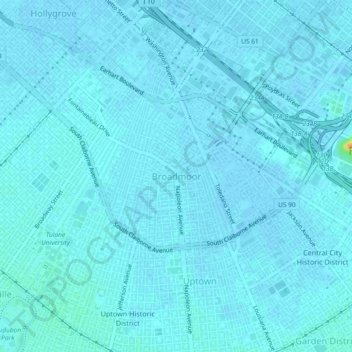
Nom : Carte topographique Broadmoor, altitude, relief.
Altitude moyenne : 2 m
Altitude minimum : -1 m
Altitude maximum : 31 m
Broadmoor is located at 29°56′56″N 90°06′15″W / 29.94889°N 90.10417°W / 29.94889; -90.10417 and has an elevation of 2 feet (0.6 m). According to the United States Census Bureau, the district has a total area of 0.56 square miles (1.5 km2). 0.56 square miles (1.5 km2) of which is land and 0.00 square miles (0.0 km2) (0.00%) of which is water.