

Carte topographique Hansel Mountains
Cliquez sur la carte pour afficher l’altitude.
Hansel Mountains
Located in northeast Box Elder County, the southwest of the range abuts the Locomotive Springs State Wildlife Management Area; the northeast end of the range ends at a lower elevation divide between the North Hansel Mountains that lie on the Utah-Idaho border. Snowville lies on Deep Creek in the Sage Valley to the northwest. Interstate 84 travels northwest-southeast through the mountain divide. The mountain range continues southwest and south and ends at Monument Point overlooking the Great Salt Lake to the south, and the wildlife management area to the west.
À propos de cette carte

Nom : Carte topographique Hansel Mountains, altitude, relief.
Lieu : Hansel Mountains, Box Elder County, Utah, United States (41.70363 -112.86933 41.94783 -112.62778)
Altitude moyenne : 1’472 m
Altitude minimum : 1’280 m
Altitude maximum : 2’160 m
Autres cartes topographiques
Cliquez sur une carte pour visualiser sa topographie, son altitude et son relief.
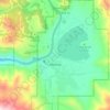
Brigham City
United States > Utah > Box Elder County
According to the United States Census Bureau, the city has a total area of 24.2 square miles (62.6 km2), of which 23.8 square miles (61.7 km2) is land and 0.35 square miles (0.9 km2), or 1.40%, is water. It lies at an elevation of 4,315 feet (1,315 m).
Altitude moyenne : 1’529 m



Brigham City
United States > Utah > Box Elder County
According to the United States Census Bureau, the city has a total area of 24.2 square miles (62.6 km2), of which 23.8 square miles (61.7 km2) is land and 0.35 square miles (0.9 km2), or 1.40%, is water. It lies at an elevation of 4,315 feet (1,315 m).
Altitude moyenne : 1’529 m
