
Carte topographique Kenilworth
Carte interactive
Cliquez sur la carte pour afficher l’altitude.
À propos de cette carte
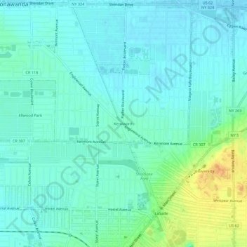
Nom : Carte topographique Kenilworth, altitude, relief.
Altitude moyenne : 192 m
Altitude minimum : 183 m
Altitude maximum : 217 m
Autres cartes topographiques
Cliquez sur une carte pour visualiser sa topographie, son altitude et son relief.
Brighton
United States > New York > Erie County > Town of Tonawanda
Brighton, Town of Tonawanda, Erie County, New York, 14223, United States
Altitude moyenne : 182 m
Green Acres Valley
United States > New York > Erie County > Town of Tonawanda
Green Acres Valley, Town of Tonawanda, Erie County, New York, 14150, United States
Altitude moyenne : 178 m