
Carte topographique Fultondale
Carte interactive
Cliquez sur la carte pour afficher l’altitude.
Fultondale
Due to difficult topography, for many years Fultondale was limited in its ability to grow. However, as technology improved, the ability to convert what had been difficult to unusable land for retail and commercial purposes improved. Besides the retail development of Colonial Promenade, other retail development nearby includes Lowe's and various chain restaurants such as O'Charley's and Outback Steakhouse. Other older, more mature business establishments line US 31 in the center of the community including supermarkets, casual fast food, banks, a bowling alley and skating rink.
À propos de cette carte
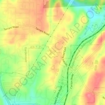
Nom : Carte topographique Fultondale, altitude, relief.
Lieu : Fultondale, Jefferson County, Alabama, United States (33.63460 -86.78918 33.63555 -86.78769)
Altitude moyenne : 190 m
Altitude minimum : 147 m
Altitude maximum : 224 m
Autres cartes topographiques
Cliquez sur une carte pour visualiser sa topographie, son altitude et son relief.