
Carte topographique Villanúa
Carte interactive
Cliquez sur la carte pour afficher l’altitude.
À propos de cette carte
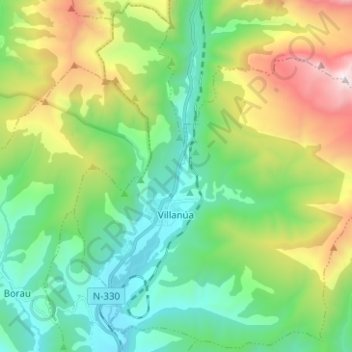
Nom : Carte topographique Villanúa, altitude, relief.
Lieu : Villanúa, Jacetania, Huesca, Aragon, 22870, Spain (42.64379 -0.56716 42.73401 -0.44207)
Altitude moyenne : 1’499 m
Altitude minimum : 895 m
Altitude maximum : 2’872 m
Villanúa (in Aragonese: Bellanuga[1][2]) is a Pyrenean municipality in Spain in the north of Huesca province, in la Jacetania, set where the Aragon valley gets wider. Its name refers to the "new village" repopulated in the late 10th century. Villanúa's altitude is 953 m and it covers 58.2 km2. The village is at the bottom of mount Collarada (2886 m) and in 2018 had 447 inhabitants.
Autres cartes topographiques
Cliquez sur une carte pour visualiser sa topographie, son altitude et son relief.