
Carte topographique Shoush
Carte interactive
Cliquez sur la carte pour afficher l’altitude.
À propos de cette carte
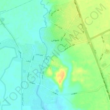
Nom : Carte topographique Shoush, altitude, relief.
Lieu : Shoush, بخش مرکزی, Shush County, Khuzestan Province, Iran (32.17572 48.22243 32.21418 48.26273)
Altitude moyenne : 78 m
Altitude minimum : 67 m
Altitude maximum : 95 m
Autres cartes topographiques
Cliquez sur une carte pour visualiser sa topographie, son altitude et son relief.
شهرک قدس
Iran > Khuzestan Province > Shush County
شهرک قدس, بخش فتح المبین, Shush County, Khuzestan Province, Iran
Altitude moyenne : 122 m