Carte topographique Chandigarh
Cliquez sur la carte pour afficher l’altitude.
Chandigarh
Chandigarh is located by the foothills of the Shivalik Range of the Himalayas in northwest India. It covers an area of approximately 114 km2. It borders the states of Punjab and Haryana. The exact geographic coordinates of Chandigarh are 30°44′N 76°47′E / 30.74°N 76.79°E / 30.74; 76.79. It has an average elevation of 321 metres (1053 ft).
À propos de cette carte
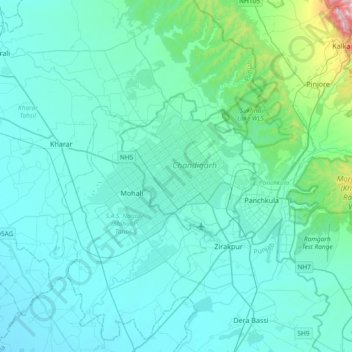
Nom : Carte topographique Chandigarh, altitude, relief.
Lieu : Chandigarh, 160018, India (30.57344 76.61971 30.89344 76.93971)
Altitude moyenne : 378 m
Altitude minimum : 276 m
Altitude maximum : 1’651 m
Autres cartes topographiques
Cliquez sur une carte pour visualiser sa topographie, son altitude et son relief.