
Carte topographique Whatcom Falls Park
Carte interactive
Cliquez sur la carte pour afficher l’altitude.
À propos de cette carte
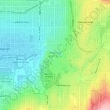
Nom : Carte topographique Whatcom Falls Park, altitude, relief.
Altitude moyenne : 75 m
Altitude minimum : 15 m
Altitude maximum : 199 m
Autres cartes topographiques
Cliquez sur une carte pour visualiser sa topographie, son altitude et son relief.
Bellingham
United States > Washington > Whatcom County > Bellingham
Bellingham, Whatcom County, Washington, 98225-3243, United States
Altitude moyenne : 129 m