
Carte topographique Hope Valley
Carte interactive
Cliquez sur la carte pour afficher l’altitude.
À propos de cette carte
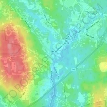
Nom : Carte topographique Hope Valley, altitude, relief.
Altitude moyenne : 54 m
Altitude minimum : 21 m
Altitude maximum : 116 m
Autres cartes topographiques
Cliquez sur une carte pour visualiser sa topographie, son altitude et son relief.
Ashaway
United States > Rhode Island > South County > Hopkinton > Ashaway
Ashaway, Hopkinton, South County, Rhode Island, 02804, United States
Altitude moyenne : 31 m
Ell Pond
United States > Rhode Island > South County > Hopkinton
Ell Pond, Hopkinton, South County, Rhode Island, United States
Altitude moyenne : 105 m
Hope Valley
United States > Rhode Island > South County > Hopkinton > Hope Valley
Hope Valley, Hopkinton, South County, Rhode Island, 02832, United States
Altitude moyenne : 55 m