

Carte topographique Panruti
Cliquez sur la carte pour afficher l’altitude.
Panruti
Panruti is located at 11.77°N 79.55°E. Panruti is located on the main line of high ways. National highway NH-36 passes through this town, connects Vikravandi and Mannargudi. State Highway SH-68 which connects Cuddalore - Sankarapuram passes through Panruti. The town lies in mainway of Chennai and Kumbakonam. The town is well-connected with major cities in Tamilnadu.It has an average elevation of 32 metres (104 feet). The Gadilam River flows through the town and Thenpennai River is nearby.
À propos de cette carte
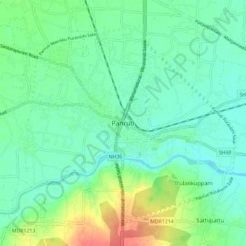
Nom : Carte topographique Panruti, altitude, relief.
Lieu : Panruti, Cuddalore, Tamil Nadu, 607106, India (11.73228 79.51190 11.81228 79.59190)
Altitude moyenne : 32 m
Altitude minimum : 16 m
Altitude maximum : 71 m
Autres cartes topographiques
Cliquez sur une carte pour visualiser sa topographie, son altitude et son relief.
