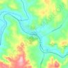
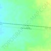
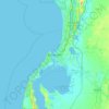
Carte topographique Lake Varley
Cliquez sur la carte pour afficher l’altitude.
À propos de cette carte

Nom : Carte topographique Lake Varley, altitude, relief.
Lieu : Lake Varley, Shire of Kulin, Western Australia, Australia (-32.70238 119.35377 -32.66050 119.37818)
Altitude moyenne : 316 m
Altitude minimum : 306 m
Altitude maximum : 371 m
Autres cartes topographiques
Cliquez sur une carte pour visualiser sa topographie, son altitude et son relief.
Perth
Perth, the capital of Western Australia, is situated on the Swan Coastal Plain, a flat expanse of sandy soil nestled between the Indian Ocean to the west and the Darling Scarp to the east. The Darling Scarp, also known as the Darling Range, is a low escarpment that extends north–south, marking a distinct…
Altitude moyenne : 26 m



Darlington
Very early on, because of its altitude and separation from the Swan Coastal Plain, Darlington became established as a popular picnic area, country drive destination, and a place for holiday homes.
Altitude moyenne : 154 m