
Faire un don
Équipez-vous pour votre prochaine aventure :
En tant que Partenaire Amazon, ce site perçoit une commission sur les achats éligibles sans surcoût pour vous.
Carte topographique Loch Tay
Cliquez sur la carte pour afficher l’altitude.
Faire un don
Équipez-vous pour votre prochaine aventure :
En tant que Partenaire Amazon, ce site perçoit une commission sur les achats éligibles sans surcoût pour vous.
Loch Tay
In the Early Medieval period people began to cultivate the higher elevations of the hills around the loch. The Macnabs, the Menzies, the Drummonds, the Napiers, the Haldanes, the MacGregors and the Robertsons of Carwhin and Strowan all owned land around the loch but little remains of their possible castles/manoors. Most of the surviving lordly residences are associated with the Glenorchy Campbells, who grew in power and influence during the 15th and early 16th centuries, specifically those at Lawers, Carwhin and Edramucky.
Faire un don
Équipez-vous pour votre prochaine aventure :
En tant que Partenaire Amazon, ce site perçoit une commission sur les achats éligibles sans surcoût pour vous.
À propos de cette carte
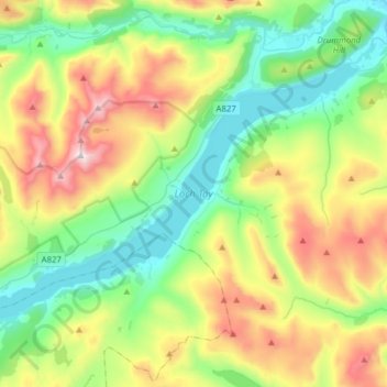
Nom : Carte topographique Loch Tay, altitude, relief.
Lieu : Loch Tay, Kenmore, Perth and Kinross, Scotland, United Kingdom (56.46929 -4.30815 56.58625 -3.99615)
Altitude moyenne : 460 m
Altitude minimum : 93 m
Altitude maximum : 1’204 m
Faire un don
Équipez-vous pour votre prochaine aventure :
En tant que Partenaire Amazon, ce site perçoit une commission sur les achats éligibles sans surcoût pour vous.