Géolocaliser

Carte topographique Chintamani

Cliquez sur la carte pour afficher l’altitude.

Chintamani

Chintamani lies in the southeast of the South Indian state of Karnataka. It is in the heart of the Mysore Plateau at an average elevation of 865 m (2,838 ft). The Taluk geographically lies between 78°12′36″N 13°16′38″E / 78.21000°N 13.27722°E / 78.21000; 13.27722 and 77°51′39″N 13°42′00″E / 77.86083°N 13.70000°E / 77.86083; 13.70000. The Chintamani Town lies between 13°24′N 78°04′E / 13.40°N 78.06°E / 13.40; 78.06.

Wikipedia (CC-BY-SA 3.0)

À propos de cette carte

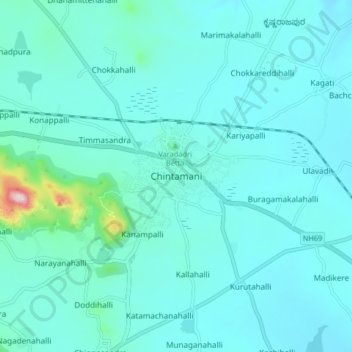
Nom : Carte topographique Chintamani, altitude, relief.

Lieu : Chintamani, Chintamani taluk, Chikkaballapura, Karnataka, 563125, India (13.35866 78.01331 13.43866 78.09331)

Altitude moyenne : 886 m

Altitude minimum : 833 m

Altitude maximum : 1’336 m

Équipez-vous pour votre prochaine aventure :

🧊Sac isotherme léger - Gardez vos provisions au frais pendant vos marches d'été
🍽️Popotes de camping - Ustensiles légers pour repas en bivouac
🪜Bâtons de marche - Bâtons télescopiques pour stabilité et endurance
🧷Kit de réparation textile - Réparez un accroc sur votre veste ou votre tente immédiatement
🔥Réchauds de camping - Réchauds compacts pour cuisine outdoor

En tant que Partenaire Amazon, ce site perçoit une commission sur les achats éligibles sans surcoût pour vous.