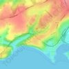
Carte topographique Bonvilston
Cliquez sur la carte pour afficher l’altitude.
Bonvilston
In the 19th century, Richard Bassett, a prominent figure in Glamorgan resided at Bonvilston House and owned the manor. The 1811 A Topographical Dictionary of The Dominion of Wales by Nicholas Carlisle said of the village.
À propos de cette carte

Nom : Carte topographique Bonvilston, altitude, relief.
Lieu : Bonvilston, Vale of Glamorgan, Wales, CF5 6TY, United Kingdom (51.43855 -3.36566 51.47855 -3.32566)
Altitude moyenne : 83 m
Altitude minimum : 17 m
Altitude maximum : 138 m
Autres cartes topographiques
Cliquez sur une carte pour visualiser sa topographie, son altitude et son relief.


Cosmeston Lakes Country Park
United Kingdom > Wales > Vale of Glamorgan > Penarth
Altitude moyenne : 26 m