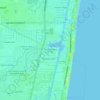
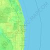
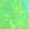
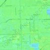
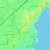
Carte topographique Lake
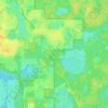
Cliquez sur la carte pour afficher l’altitude.
À propos de cette carte

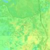
Nom : Carte topographique Lake, altitude, relief.
Lieu : Lake, St. Johns County, Florida, United States (29.80256 -81.38224 29.81242 -81.37825)
Altitude moyenne : 13 m
Altitude minimum : 8 m
Altitude maximum : 17 m
Autres cartes topographiques
Cliquez sur une carte pour visualiser sa topographie, son altitude et son relief.
Hudson
United States > Florida > Hudson
Hudson features a predominantly flat and low-lying topography typical of the region, with an average elevation of approximately 16 feet above sea level. This terrain is interspersed with various wetlands and small lakes, creating a rich ecosystem that supports diverse wildlife. The area also includes a few…
Altitude moyenne : 5 m



Florida Keys
United States > Florida > Monroe County
The Florida Keys, an archipelago extending about 120 miles from the southeastern tip of Florida, feature a unique topography characterized by low-lying coral islands and a series of intricate waterways. Most islands are less than 5 feet above sea level, contributing to their vulnerability to storm surges and…
Altitude moyenne : 0 m



Coral Ridge
United States > Florida > Broward County > Fort Lauderdale > Coral Ridge
Altitude moyenne : 5 m








Bonita National Golf & Country Club
United States > Florida > Lee County > Bonita Springs
Altitude moyenne : 5 m

City of Tampa Waterworks Dam
United States > Florida > Hillsborough County > Tampa > Altos Verdes
Altitude moyenne : 13 m

Largo
United States > Florida > Pinellas County > Largo
In 2010, Largo's total area was 18.6 square miles (48.1 km2), of which 17.6 square miles (45.6 km2) was land and 0.97 square miles (2.5 km2), or 5.22%, was water. As of 2004, there were 651 acres (2.6 km2) of park lands. The city's lowest elevation is sea level. At its highest, the city's elevation is about 69…
Altitude moyenne : 5 m
Tallahassee
United States > Florida > Leon County > Tallahassee
Tallahassee's terrain is hilly by Florida standards, being at the southern end of the Red Hills Region, just above the Cody Scarp. The elevation varies from near sea level to just over 200 feet (61 m), with the state capitol on one of the highest hills in the city. The city includes two large lake basins, Lake…
Altitude moyenne : 32 m



San Mateo
United States > Florida > Putnam County
San Mateo is located at 29°36′25″N 81°35′06″W / 29.607°N 81.585°W / 29.607; -81.585, with an elevation of 72 feet (22 m).
Altitude moyenne : 10 m


Halifax Estates
United States > Florida > Volusia County > Daytona Beach Shores
Altitude moyenne : 1 m




South Fork New River
United States > Florida > Broward County > Fort Lauderdale
Altitude moyenne : 7 m


Alice C Wainwright Park
United States > Florida > Miami-Dade County > Miami > Brickell Hammock
Altitude moyenne : 6 m

Saint James Mobile Home Park
United States > Florida > Lee County > Saint James City
Altitude moyenne : 1 m