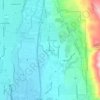
Carte topographique Eagle Mountain
Cliquez sur la carte pour afficher l’altitude.
Eagle Mountain
Eagle Mountain's climate varies drastically between the northeastern Ranches area and the southwestern City Center area. Despite being further south than Salt Lake City, both areas have cooler temperatures due to sitting at a higher elevation. The Ranches section of the city has slightly milder temperatures since it is closer to the moderating impact of the Salt Lake and Utah Valleys as well as the Great Salt Lake, which gives it a climate more similar to Salt Lake City. The City Center area near Fairfield lies in the Cedar Valley, which cuts that area off from the moderating influence of the Salt Lake Valley and Great Salt lake. This causes nights to get significantly colder than in the Ranches but also puts it in a rain shadow causing less precipitation and more sunshine than the Ranches part of the city.
À propos de cette carte
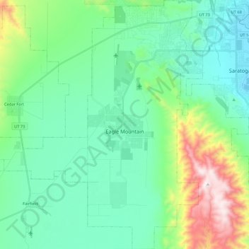
Nom : Carte topographique Eagle Mountain, altitude, relief.
Lieu : Eagle Mountain, Utah County, Utah, 84005, United States (40.23225 -112.13010 40.39496 -111.94501)
Altitude moyenne : 1’589 m
Altitude minimum : 1’366 m
Altitude maximum : 2’339 m
Autres cartes topographiques
Cliquez sur une carte pour visualiser sa topographie, son altitude et son relief.