Géolocaliser

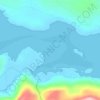
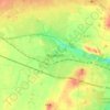
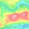
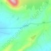
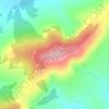
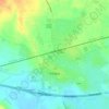
Carte topographique Irongrange Lower

Cliquez sur la carte pour afficher l’altitude.

À propos de cette carte

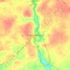
Nom : Carte topographique Irongrange Lower, altitude, relief.

Lieu : Irongrange Lower, Baltinglass ED, The Municipal District of Baltinglass, County Wicklow, Leinster, Ireland (52.92108 -6.73145 52.93110 -6.71605)

Altitude moyenne : 139 m

Altitude minimum : 113 m

Altitude maximum : 226 m

Autres cartes topographiques

Cliquez sur une carte pour visualiser sa topographie, son altitude et son relief.
Cork

Ireland > County Cork > Cork

Altitude moyenne : 94 m

Swords

Ireland > County Dublin > Swords

The medieval town developed in a linear pattern along Main Street, in a roughly north-south direction. Swords has one of the best examples of this settlement pattern in the Dublin region. The round tower, 26m in height, is also an indicator of early Christian settlement. The Irish high king Brian Boru is said…

Altitude moyenne : 28 m

River Shannon

Ireland

Altitude moyenne : 39 m

Athlone

Ireland > County Westmeath > Athlone

Altitude moyenne : 44 m

Galway City

Ireland > Galway City

Altitude moyenne : 26 m

Cromane

Ireland

Altitude moyenne : 3 m

Maghera Strand

Ireland

Altitude moyenne : 37 m

Knockdrin

Ireland

Altitude moyenne : 96 m

Ballycurry

Ireland

Altitude moyenne : 178 m

Ballyedmond

Ireland

Altitude moyenne : 73 m

Furry Glen

Ireland

Altitude moyenne : 44 m

Trout Lake

Ireland

Altitude moyenne : 81 m

Tory Hill

Ireland

Altitude moyenne : 131 m

Dowth

Ireland

Altitude moyenne : 32 m

Great Skellig

Ireland

Altitude moyenne : 1 m

Spinans Hill

Ireland

Altitude moyenne : 244 m

Gaulstown Castle

Ireland

Altitude moyenne : 181 m

Skeaghvasteen

Ireland

Altitude moyenne : 97 m

Tibberaghny Castle

Ireland

Altitude moyenne : 18 m

Myles Big Stone

Ireland

Altitude moyenne : 89 m

Kilkee Cliffs

Ireland

Altitude moyenne : 19 m

Dunlicky Point

Ireland

Altitude moyenne : 18 m

Doulus Head

Ireland

Altitude moyenne : 16 m

Bolus Head

Ireland

Altitude moyenne : 28 m
Galley Head

Ireland

Altitude moyenne : 3 m

Downeen Point

Ireland

Altitude moyenne : 11 m

Frower Point

Ireland

Altitude moyenne : 20 m

Knockadoon Head

Ireland

Altitude moyenne : 6 m

Mine Head

Ireland

Altitude moyenne : 22 m

Glendoo Mountain

Ireland

Altitude moyenne : 480 m

Crohy Head Sea Arch

Ireland

Altitude moyenne : 28 m

Dawros Bay

Ireland

Altitude moyenne : 6 m

Portacloy Bay

Ireland

Altitude moyenne : 57 m

Mace Head

Ireland

Altitude moyenne : 3 m

Doonbeg Head

Ireland

Altitude moyenne : 32 m

Lambs Head Bay

Ireland

Altitude moyenne : 14 m

Clifden Bay

Ireland

Altitude moyenne : 41 m

Galway Bay

Ireland

Altitude moyenne : 0 m

Dollymount

Ireland

Altitude moyenne : 6 m

Knocksink Wood

Ireland > County Wicklow

Altitude moyenne : 175 m

Drogheda

Ireland > County Louth > Drogheda

Altitude moyenne : 38 m

Howth

Ireland > County Dublin

Altitude moyenne : 8 m

Ballinacourty

Ireland > County Waterford

Altitude moyenne : 3 m
Castletownroche

Ireland > County Cork

Altitude moyenne : 67 m

Carrauntoohil

Ireland > County Kerry

Carrauntoohil is the highest mountain in Ireland on all classification scales. It is the 133rd-highest mountain, and 4th most prominent mountain, in Britain and Ireland, on the Simms classification. Carrauntoohil is regarded by the Scottish Mountaineering Club (SMC) as one of 34 Furths, which are defined as…

Altitude moyenne : 644 m

Mountbellew

Ireland > County Galway

Altitude moyenne : 69 m

Feakle

Ireland > County Clare

Altitude moyenne : 109 m

Carlow

Ireland > Carlow

Altitude moyenne : 63 m

Ennis

Ireland > County Clare > Ennis

Altitude moyenne : 20 m

Dundalk

Ireland > County Louth > Dundalk

Altitude moyenne : 16 m

Mallow

Ireland > County Cork > Mallow

Altitude moyenne : 106 m

Maynooth

Ireland > County Kildare > Maynooth

Altitude moyenne : 66 m

Lough Nacarriga

Ireland > County Leitrim

Altitude moyenne : 73 m

Ballyogan

Ireland > County Dublin

Altitude moyenne : 116 m

Enniscorthy

Ireland > County Wexford > Enniscorthy

Altitude moyenne : 44 m
Castlebridge

Ireland > County Wexford

Altitude moyenne : 18 m

White Strand Beach

Ireland > Knightstown

Altitude moyenne : 8 m

Kinneigh Round Tower

Ireland > County Cork

Altitude moyenne : 122 m

Staigue

Ireland > County Kerry

Altitude moyenne : 157 m

Knocknatulla

Ireland > County Meath > Knocknatulla

Altitude moyenne : 76 m

Cobh

Ireland > County Cork > Cobh Municipal District > Cobh

Altitude moyenne : 23 m

Cliffs of Moher

Ireland > County Clare

Altitude moyenne : 55 m

Tonduff

Ireland > County Wicklow

Altitude moyenne : 496 m

Ennistimon

Ireland > County Clare > Ennistimon

Altitude moyenne : 61 m

Brookville Park

Ireland > County Louth

Altitude moyenne : 26 m

Errina Canal

Ireland > County Clare

Altitude moyenne : 11 m

Coppeen

Ireland > County Cork

Altitude moyenne : 169 m

Lispole

Ireland > County Kerry

Altitude moyenne : 107 m

Model Village

Ireland > County Cork

Altitude moyenne : 100 m

Mahon Falls

Ireland > County Waterford

Altitude moyenne : 575 m

Cupidstown Hill

Ireland > County Kildare

Altitude moyenne : 289 m

Fore

Ireland > County Westmeath

Altitude moyenne : 110 m

Ballineen

Ireland > County Cork

Altitude moyenne : 76 m

Roches Point

Ireland > County Cork

Altitude moyenne : 8 m

Goatenbridge

Ireland > County Tipperary

Altitude moyenne : 57 m

Windgap

Ireland > County Kilkenny

Altitude moyenne : 149 m

Forth Mountain

Ireland > County Wexford

Altitude moyenne : 154 m

Tooreen

Ireland > County Tipperary

Altitude moyenne : 312 m

Rosscahill

Ireland > County Galway

Altitude moyenne : 36 m
Glenmalure

Ireland > County Wicklow

Altitude moyenne : 295 m

Saint Catherine's Park

Ireland > County Dublin > Leixlip

Altitude moyenne : 48 m

Donabate Beach

Ireland > County Dublin

Altitude moyenne : 2 m

New Twopothouse

Ireland > County Cork

Altitude moyenne : 114 m

Trim Castle Keep

Ireland > County Meath > Trim

Altitude moyenne : 62 m

Letterkenny

Ireland > County Donegal > Letterkenny

Altitude moyenne : 93 m

Kildare

Ireland > Kildare

Altitude moyenne : 102 m

Naas

Ireland > Naas

Altitude moyenne : 102 m

Clonmel

Ireland > County Tipperary > Clonmel

Altitude moyenne : 106 m

Dungarvan

Ireland > County Waterford

Altitude moyenne : 30 m

Mullingar

Ireland > County Westmeath

Altitude moyenne : 101 m

Bray

Ireland > County Wicklow > Bray

Altitude moyenne : 58 m

Killarney

Ireland > County Kerry > Killarney

Altitude moyenne : 66 m

Midleton

Ireland > Midleton

Altitude moyenne : 42 m

Clonakilty

Ireland > Clonakilty

Altitude moyenne : 49 m

Balbriggan

Ireland > County Dublin > Balbriggan

Altitude moyenne : 25 m

Greystones

Ireland > County Wicklow

Greystones is located south of the site of an ancient castle of the Barony of Rathdown. There was a hamlet which, like Rathdown Castle, was known as Rathdown, and which appeared on a 1712 map. This site occupied an area now known as the Grove, north of Greystones harbour, but only the ruins of a chapel, St.…

Altitude moyenne : 49 m
Tramore

Ireland > Tramore

Altitude moyenne : 30 m

Limerick

Ireland > Limerick

Limerick's climate is classified as temperate oceanic (Köppen Cfb). Met Éireann maintains a climatological weather station at Shannon Airport, 20 kilometres west of the city in County Clare. Shannon Airport records an average of 977 millimetres of precipitation annually, most of which is rain. Limerick has a…

Altitude moyenne : 54 m

Équipez-vous pour votre prochaine aventure :

🪑Siège de randonnée pliable - Le confort d'une pause assise sans le poids encombrant
🧳Sacs de transport outdoor - Organisation du matériel
🚴Compteur vélo avec cartographie - Suivez vos performances et votre itinéraire sur les routes de Suisse
🔋Chargeur Solaire Portatif - Autonomie énergétique pour vos longues randonnées en autonomie
👒Bandeau de sport hiver - Protégez vos oreilles du froid sans surchauffe

En tant que Partenaire Amazon, ce site perçoit une commission sur les achats éligibles sans surcoût pour vous.