
Carte topographique Thada
Carte interactive
Cliquez sur la carte pour afficher l’altitude.
À propos de cette carte
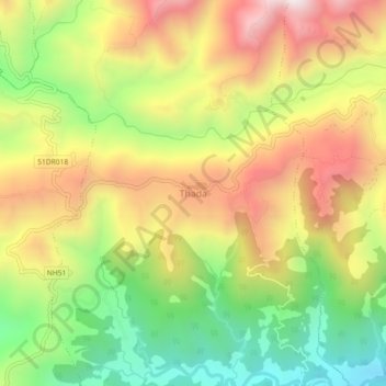
Nom : Carte topographique Thada, altitude, relief.
Lieu : Thada, Shitaganga, Arghakhanchi, Nepal (27.84137 83.07597 27.88137 83.11597)
Altitude moyenne : 1’123 m
Altitude minimum : 681 m
Altitude maximum : 1’588 m
Autres cartes topographiques
Cliquez sur une carte pour visualiser sa topographie, son altitude et son relief.
Thada
Nepal > Arghakhanchi > Thada
Thada, Sitganga, Arghakhanchi, Lumbini Province, Nepal
Altitude moyenne : 953 m
Dharapani
Dharapani, Bhumekasthan, Arghakhanchi, Lumbini Province, Nepal
Altitude moyenne : 1’195 m