Géolocaliser

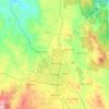
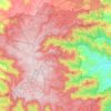
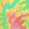
Carte topographique Black Spring

Cliquez sur la carte pour afficher l’altitude.

À propos de cette carte

Nom : Carte topographique Black Spring, altitude, relief.

Lieu : Black Spring, Snowy Monaro Regional Council, New South Wales, Australia (-36.98354 149.22187 -36.96354 149.24187)

Altitude moyenne : 739 m

Altitude minimum : 713 m

Altitude maximum : 782 m

Autres cartes topographiques

Cliquez sur une carte pour visualiser sa topographie, son altitude et son relief.
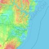
Sydney

Australia > New South Wales

Sydney's topography is characterized by a diverse landscape that seamlessly blends coastal features with inland plateaus. The city is divided into two primary regions: the relatively flat Cumberland Plain to the south and west of Sydney Harbour, and the elevated Hornsby Plateau to the north. The Cumberland…

Altitude moyenne : 51 m
Newcastle

Australia > New South Wales > Newcastle

Altitude moyenne : 5 m

Cooma

Australia > New South Wales

Altitude moyenne : 869 m

Orange

Australia > New South Wales

Orange is a city in the Central Tablelands region of New South Wales, Australia. It is 254 km (158 mi) west of the state capital, Sydney [206 km (128 mi) on a great circle], at an altitude of 862 metres (2,828 ft). Orange had an estimated urban population of 40,493 as of June 2018 making the city a significant…

Altitude moyenne : 852 m

Penrith

Australia > New South Wales > Sydney > Penrith

Penrith is a city in New South Wales, Australia, located in Greater Western Sydney, 55 kilometres (31 mi) west of the Sydney central business district on the banks of the Nepean River, on the outskirts of the Cumberland Plain. Its elevation is 32 metres (105 ft).

Altitude moyenne : 34 m

Gerringong

Australia > New South Wales

Altitude moyenne : 37 m

Woombah

Australia > New South Wales

Altitude moyenne : 14 m

Cooranbong

Australia > New South Wales

Altitude moyenne : 72 m

Port Macquarie

Australia > New South Wales

Altitude moyenne : 5 m

Gulmarrad

Australia > New South Wales

Altitude moyenne : 10 m

Leeton

Australia > New South Wales

Altitude moyenne : 156 m

Bagotville

Australia > New South Wales

Altitude moyenne : 14 m

Goulburn

Australia > New South Wales

Owing to its elevation, Goulburn has an oceanic climate (Cfb) with warm summers and cool winters; with a high diurnal range. Its climate is variable much of the year, though generally dry with maximum temperatures ranging from 11.8 °C (53.2 °F) in July to 28.3 °C (82.9 °F) in January. Rainfall is…

Altitude moyenne : 666 m

Wardell

Australia > New South Wales

Altitude moyenne : 10 m

Curramore

Australia > New South Wales

Altitude moyenne : 143 m

Barrington Tops

Australia > New South Wales

Altitude moyenne : 1’107 m

Kyogle Council

Australia > New South Wales

Altitude moyenne : 315 m

Sydney

Australia > New South Wales > Sydney

Altitude moyenne : 23 m

Manning River

Australia > New South Wales

Altitude moyenne : 338 m

Mangrove Creek

Australia > New South Wales

Altitude moyenne : 144 m

Denman

Australia > New South Wales

Altitude moyenne : 164 m

Sydney

Australia > New South Wales

Sydney's topography is characterized by a diverse landscape that seamlessly blends coastal features with inland plateaus. The city is divided into two primary regions: the relatively flat Cumberland Plain to the south and west of Sydney Harbour, and the elevated Hornsby Plateau to the north. The Cumberland…

Altitude moyenne : 51 m

North Ryde

Australia > New South Wales > Sydney

Altitude moyenne : 52 m

Oatley

Australia > New South Wales > Sydney

Altitude moyenne : 24 m

Glenwood

Australia > New South Wales

Altitude moyenne : 69 m

Lower Portland

Australia > New South Wales

Altitude moyenne : 67 m

Dunoon

Australia > New South Wales

Altitude moyenne : 142 m

Burringbar

Australia > New South Wales

Altitude moyenne : 81 m

Guthega

Australia > New South Wales

Altitude moyenne : 1’743 m

West Wyalong

Australia > New South Wales

Altitude moyenne : 257 m

Culburra Beach

Australia > New South Wales

Altitude moyenne : 5 m

Matong

Australia > New South Wales

Altitude moyenne : 178 m

Little Billabong

Australia > New South Wales

Altitude moyenne : 417 m

Liston

Australia > New South Wales

Altitude moyenne : 855 m

Isabella

Australia > New South Wales

Altitude moyenne : 1’070 m

Boxers Creek

Australia > New South Wales

Altitude moyenne : 689 m

Upper Macdonald

Australia > New South Wales

Altitude moyenne : 136 m

Grafton

Australia > New South Wales > Grafton

Altitude moyenne : 5 m

Uriarra

Australia > New South Wales

Altitude moyenne : 808 m

Delegate

Australia > New South Wales

Altitude moyenne : 841 m

Uralla Shire Council

Australia > New South Wales

Altitude moyenne : 928 m

Long Jetty

Australia > New South Wales

Altitude moyenne : 9 m

Yass

Australia > New South Wales

Yass is located 280 km south-west of Sydney, on the Hume Highway. The Yass River, which is a tributary of the Murrumbidgee River, flows through the town. Yass is 59 km from Canberra; lying at an elevation of 505 m AMSL.

Altitude moyenne : 533 m
Byron Bay

Australia > New South Wales

Byron Bay, located in northeastern New South Wales, Australia, is characterized by diverse topography shaped by its geological history. The town is part of the erosion caldera of the ancient Tweed Volcano, which erupted approximately 23 million years ago, resulting in the rich volcanic soils that define the…

Altitude moyenne : 7 m

Mudgee

Australia > New South Wales

Altitude moyenne : 535 m

Taree

Australia > New South Wales

Altitude moyenne : 17 m

Dulwich Hill

Australia > New South Wales > Sydney

Altitude moyenne : 27 m

South Grafton

Australia > New South Wales

Altitude moyenne : 36 m

Tantangara Reservoir

Australia > New South Wales

Altitude moyenne : 1’276 m

Narara

Australia > New South Wales

Altitude moyenne : 55 m

North Arm Cove

Australia > New South Wales

Altitude moyenne : 32 m

Harrington

Australia > New South Wales

Altitude moyenne : 3 m

Fitzroy Falls

Australia > New South Wales

Altitude moyenne : 575 m

Mollymook Beach

Australia > New South Wales

Altitude moyenne : 18 m

Wollongong

Australia > New South Wales

Altitude moyenne : 16 m

Huonbrook

Australia > New South Wales

Altitude moyenne : 441 m

Corndale

Australia > New South Wales

Altitude moyenne : 81 m

Lewis Ponds

Australia > New South Wales

Altitude moyenne : 821 m

Collaroy Beach

Australia > New South Wales > Sydney

Altitude moyenne : 22 m

Shoalhaven Heads

Australia > New South Wales

Altitude moyenne : 5 m

Central Coast Council

Australia > New South Wales

Altitude moyenne : 103 m

Moruya

Australia > New South Wales

Altitude moyenne : 37 m

Parramatta

Australia > New South Wales

Altitude moyenne : 22 m

Armidale

Australia > New South Wales

Altitude moyenne : 1’036 m

Bowral

Australia > New South Wales

Altitude moyenne : 690 m

Campbelltown

Australia > New South Wales

Altitude moyenne : 96 m

Greystanes

Australia > New South Wales > Sydney

Altitude moyenne : 53 m

Terrigal

Australia > New South Wales

Altitude moyenne : 13 m

Annandale

Australia > New South Wales > Sydney

Altitude moyenne : 24 m

Mittagong

Australia > New South Wales

Altitude moyenne : 672 m

Glen Innes

Australia > New South Wales

Altitude moyenne : 1’083 m

Menangle

Australia > New South Wales

Altitude moyenne : 121 m

Leura

Australia > New South Wales

Leura's elevation of 985 metres (3,232 ft) AHD  leads to occasional snowfall in winter and a climate that reflects all four seasons distinctly.

Altitude moyenne : 880 m

Glebe

Australia > New South Wales > Sydney

Altitude moyenne : 18 m

Uki

Australia > New South Wales

Altitude moyenne : 84 m

Murwillumbah

Australia > New South Wales

Altitude moyenne : 7 m

King Creek

Australia > New South Wales > Wauchope > King Creek

Altitude moyenne : 6 m

Emmaville

Australia > New South Wales

Emmaville is at an elevation of 890 metres AHD. At the 2006 census, the Emmaville "urban centre/locality" had a population of 247 (in the 2001 census it was 303) and there were 535 persons usually resident in the Emmaville region.

Altitude moyenne : 859 m

Hat Head

Australia > New South Wales

Altitude moyenne : 4 m

Engadine

Australia > New South Wales > Sydney

Altitude moyenne : 121 m

Marsden Park

Australia > New South Wales

Altitude moyenne : 31 m

Asquith

Australia > New South Wales

Altitude moyenne : 168 m

Riverwood

Australia > New South Wales > Sydney

Altitude moyenne : 22 m

Équipez-vous pour votre prochaine aventure :

🧭Boussole de précision - Idéale pour l'orientation avec cartes topographiques en milieu alpin
🛠️Outils multifonctions - Réparations et usages polyvalents
🎒Sac d'hydratation VTT - Design ergonomique pour ne pas gêner les mouvements en descente
🍽️Set de cuisine camping - Ustensiles légers et emboîtables pour optimiser la place dans le sac
🧦Chaussettes de randonnée - Chaussettes techniques anti-ampoules

En tant que Partenaire Amazon, ce site perçoit une commission sur les achats éligibles sans surcoût pour vous.