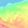
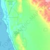
Carte topographique El Questro Station
Cliquez sur la carte pour afficher l’altitude.
À propos de cette carte

Nom : Carte topographique El Questro Station, altitude, relief.
Altitude moyenne : 161 m
Altitude minimum : 91 m
Altitude maximum : 372 m
Autres cartes topographiques
Cliquez sur une carte pour visualiser sa topographie, son altitude et son relief.









Katanning
Katanning railway station has an elevation of 1,024 feet (312 m) above sea level and a rail distance of 225 miles (362 km) from Perth.
Altitude moyenne : 323 m




Ellenbrook
The suburb sits in the south-east corner of the Gnangara Mound, close to the Darling Scarp. Topographically, the majority of Ellenbrook's area sits between 40-50 metres above sea level on the mound, with parts of Coolamon and Malvern Springs situated on hills that reach peaks of 65 metres. The northern village…
Altitude moyenne : 49 m