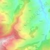
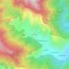
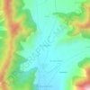
Carte topographique Ramban
Cliquez sur la carte pour afficher l’altitude.
À propos de cette carte

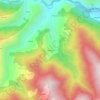
Nom : Carte topographique Ramban, altitude, relief.
Lieu : Ramban, Ramban district, Jammu and Kashmir, India (33.06691 75.01793 33.35824 75.37492)
Altitude moyenne : 1’764 m
Altitude minimum : 516 m
Altitude maximum : 3’967 m
Autres cartes topographiques
Cliquez sur une carte pour visualiser sa topographie, son altitude et son relief.
Amarnath Cave Temple
India > Jammu and Kashmir > Pahalgam
The Shiva Lingam at the shrine is a Swayambhu lingam. The lingam is a natural stalagmite formation located at the Amarnath Mountain which has a peak of 5,186 metres (17,014 ft), and inside a 40 m (130 ft) high cave at an elevation of 3,888 m (12,756 ft). The stalagmite is formed due to the freezing of water…
Altitude moyenne : 4’325 m

Khrew
India > Jammu and Kashmir > Pampore
Khrew is located at 34°01′12″N 74°59′24″E / 34.020°N 74.99°E / 34.020; 74.99. It has an average elevation of 1,607 metres (5,272 feet) and is located in the Kashmir valley. The area starts from Babapora to Seer Bagh and from Bathen to Androosa. Also, the foot region is extended to Ladhoo,…
Altitude moyenne : 1’788 m


Rajouri
India > Jammu and Kashmir > Rajauri
Rajouri is located at 33°23′N 74°18′E / 33.38°N 74.3°E / 33.38; 74.3. It has an average elevation of 915 metres (3001 feet).
Altitude moyenne : 1’038 m




Kathua
India > Jammu and Kashmir > Kathua
Kathua is located at 32°22′N 75°31′E / 32.37°N 75.52°E / 32.37; 75.52. It has an average elevation of 393 metres (1,289 ft). The city is surrounded by three rivers. Ravi is 7 km (4.3 mi) down Kathua while Ujjh is about 11 km (6.8 mi) ahead on Jammu Highway. Kathua itself is situated along the…
Altitude moyenne : 411 m