
Carte topographique Towthorpe
Carte interactive
Cliquez sur la carte pour afficher l’altitude.
À propos de cette carte
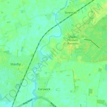
Nom : Carte topographique Towthorpe, altitude, relief.
Altitude moyenne : 18 m
Altitude minimum : 12 m
Altitude maximum : 25 m
Autres cartes topographiques
Cliquez sur une carte pour visualiser sa topographie, son altitude et son relief.
Tower Gardens, St George's Field
United Kingdom > England > York > York
Tower Gardens, St George's Field, Bishophill, York, England, United Kingdom
Altitude moyenne : 15 m
Crockey Hill
United Kingdom > England > York > York > Crockey Hill
Crockey Hill, Fulford, York, Yorkshire and the Humber, England, YO19 4SN, United Kingdom
Altitude moyenne : 10 m