Carte topographique Muscatine
Cliquez sur la carte pour afficher l’altitude.
Muscatine
Several large working-class neighborhoods and industrial sectors have been built on what is called "Muscatine Island". This flat, sandy expanse was largely underwater before a portion of the Mississippi River rerouted to follow the course of the present-day Muscatine Slough. It is unclear when the river changed course. The hills, river, and island are all integral to the diversity of Muscatine's economy and housing sector. As the city's urbanized area develops, the areas of highest elevation in the "High Prairie" crescent (between the Cedar and Mississippi Rivers) are increasingly taken from agricultural use and developed as suburban housing.
À propos de cette carte
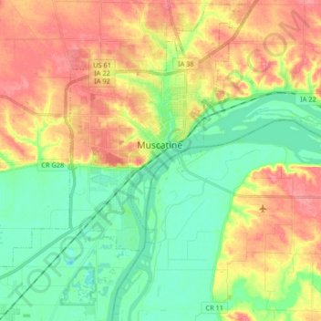
Nom : Carte topographique Muscatine, altitude, relief.
Lieu : Muscatine, Muscatine County, Iowa, 52761, United States (41.35852 -91.16135 41.47879 -90.99711)
Altitude moyenne : 189 m
Altitude minimum : 155 m
Altitude maximum : 233 m
Autres cartes topographiques
Cliquez sur une carte pour visualiser sa topographie, son altitude et son relief.