Géolocaliser

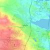
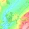
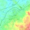
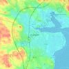
Carte topographique Bawnmore

Cliquez sur la carte pour afficher l’altitude.

À propos de cette carte

Nom : Carte topographique Bawnmore, altitude, relief.

Lieu : Bawnmore, New Ross Rural, The Municipal District of New Ross, County Wexford, Leinster, Ireland (52.39646 -6.93066 52.41208 -6.92253)

Altitude moyenne : 45 m

Altitude minimum : -9 m

Altitude maximum : 89 m

Autres cartes topographiques

Cliquez sur une carte pour visualiser sa topographie, son altitude et son relief.
Cork

Ireland > County Cork > Cork

Altitude moyenne : 94 m

Swords

Ireland > County Dublin > Swords

The medieval town developed in a linear pattern along Main Street, in a roughly north-south direction. Swords has one of the best examples of this settlement pattern in the Dublin region. The round tower, 26m in height, is also an indicator of early Christian settlement. The Irish high king Brian Boru is said…

Altitude moyenne : 28 m
Athlone

Ireland > County Westmeath > Athlone

Altitude moyenne : 44 m

River Shannon

Ireland

Altitude moyenne : 39 m

Bolus Head

Ireland

Altitude moyenne : 28 m

Downeen Point

Ireland

Altitude moyenne : 11 m

Cromane

Ireland

Altitude moyenne : 3 m

Maghera Strand

Ireland

Altitude moyenne : 37 m

Knockdrin

Ireland

Altitude moyenne : 96 m

Ballycurry

Ireland

Altitude moyenne : 178 m

Ballyedmond

Ireland

Altitude moyenne : 73 m

Furry Glen

Ireland

Altitude moyenne : 44 m

Trout Lake

Ireland

Altitude moyenne : 81 m

Tory Hill

Ireland

Altitude moyenne : 131 m

Dowth

Ireland

Altitude moyenne : 32 m

Great Skellig

Ireland

Altitude moyenne : 1 m

Spinans Hill

Ireland

Altitude moyenne : 244 m

Gaulstown Castle

Ireland

Altitude moyenne : 181 m

Skeaghvasteen

Ireland

Altitude moyenne : 97 m

Tibberaghny Castle

Ireland

Altitude moyenne : 18 m

Myles Big Stone

Ireland

Altitude moyenne : 89 m

Kilkee Cliffs

Ireland

Altitude moyenne : 19 m

Dunlicky Point

Ireland

Altitude moyenne : 18 m

Doulus Head

Ireland

Altitude moyenne : 16 m

Galley Head

Ireland

Altitude moyenne : 3 m

Frower Point

Ireland

Altitude moyenne : 20 m

Knockadoon Head

Ireland

Altitude moyenne : 6 m

Mine Head

Ireland

Altitude moyenne : 22 m

Glendoo Mountain

Ireland

Altitude moyenne : 480 m

Crohy Head Sea Arch

Ireland

Altitude moyenne : 28 m
Dawros Bay

Ireland

Altitude moyenne : 6 m

Portacloy Bay

Ireland

Altitude moyenne : 57 m

Mace Head

Ireland

Altitude moyenne : 3 m

Doonbeg Head

Ireland

Altitude moyenne : 32 m

Lambs Head Bay

Ireland

Altitude moyenne : 14 m

Clifden Bay

Ireland

Altitude moyenne : 41 m

Galway Bay

Ireland

Altitude moyenne : 0 m

Dollymount

Ireland

Altitude moyenne : 6 m

Bailieborough

Ireland > County Cavan > Bailieborough

Altitude moyenne : 169 m

Ballinacourty

Ireland > County Waterford

Altitude moyenne : 3 m

Ennis

Ireland > County Clare > Ennis

Altitude moyenne : 20 m

Galway City

Ireland > Galway City

Altitude moyenne : 26 m

Castletownroche

Ireland > County Cork

Altitude moyenne : 67 m

Aughagower

Ireland > County Mayo > Aughagower

Altitude moyenne : 70 m

Ballincollig

Ireland > County Cork > Cork

Altitude moyenne : 62 m

Knocksink Wood

Ireland > County Wicklow

Altitude moyenne : 175 m

Drogheda

Ireland > County Louth > Drogheda

Altitude moyenne : 38 m
Howth

Ireland > County Dublin

Altitude moyenne : 8 m

Lucan

Ireland > County Dublin

Altitude moyenne : 59 m
Malahide

Ireland > County Dublin > Malahide

Altitude moyenne : 10 m

Meelin

Ireland > County Cork

Altitude moyenne : 246 m

Caherlistrane

Ireland > County Galway

Altitude moyenne : 37 m

Carrauntoohil

Ireland > County Kerry

Carrauntoohil is the highest mountain in Ireland on all classification scales. It is the 133rd-highest mountain, and 4th most prominent mountain, in Britain and Ireland, on the Simms classification. Carrauntoohil is regarded by the Scottish Mountaineering Club (SMC) as one of 34 Furths, which are defined as…

Altitude moyenne : 644 m

Claureen River

Ireland > County Clare

Altitude moyenne : 14 m

Mountbellew

Ireland > County Galway

Altitude moyenne : 69 m

Upper Glanmire Bridge

Ireland > County Cork > Cork

Altitude moyenne : 90 m

Glandore

Ireland > County Cork

Altitude moyenne : 56 m

Belpere Cross

Ireland > County Meath

Altitude moyenne : 111 m

Doolin Cave

Ireland > County Clare

Altitude moyenne : 87 m

Slane

Ireland > County Meath > Slane

Altitude moyenne : 68 m

Kilternan

Ireland > County Dublin

Altitude moyenne : 173 m

White Strand Beach

Ireland > Knightstown

Altitude moyenne : 8 m

Kildare Round Tower

Ireland > County Kildare

A Topographical Dictionary of Ireland states "One of the ancient round towers stood here till 1807 when it was pulled down to make room for the belfry of the church".

Altitude moyenne : 100 m
Old Kilcullen

Ireland > County Kildare > Old Kilcullen

Altitude moyenne : 125 m

Firies

Ireland > County Kerry

Altitude moyenne : 31 m

Old Head of Kinsale

Ireland > County Cork

Altitude moyenne : 5 m

Knocknatulla

Ireland > County Meath > Knocknatulla

Altitude moyenne : 76 m

Rattoo Round Tower

Ireland > County Kerry

Altitude moyenne : 16 m

High Island

Ireland > County Galway

Altitude moyenne : 1 m

Bealaha

Ireland > County Clare

Altitude moyenne : 17 m

Staigue Fort

Ireland > County Kerry

Altitude moyenne : 191 m

Ennistimon

Ireland > County Clare > Ennistimon

Altitude moyenne : 61 m

Kerry Pike

Ireland > County Cork > Cork

Altitude moyenne : 55 m

Errina Canal

Ireland > County Clare

Altitude moyenne : 11 m

Upperchurch

Ireland > County Tipperary

Altitude moyenne : 231 m

Mahon Falls

Ireland > County Waterford

Altitude moyenne : 575 m

Glinsk

Ireland > County Mayo

Altitude moyenne : 116 m

Staleen Lock - Lock 3

Ireland > County Meath

Altitude moyenne : 50 m

Feakle

Ireland > County Clare

Altitude moyenne : 109 m

Pollduff

Ireland > County Galway

Altitude moyenne : 219 m

Gurteen

Ireland > County Galway

Altitude moyenne : 89 m

Menlough

Ireland > County Galway

Altitude moyenne : 90 m

Iveagh Gardens

Ireland > County Dublin > Dublin

Altitude moyenne : 17 m

Knock

Ireland > County Tipperary

Altitude moyenne : 129 m

Tinryland

Ireland > County Carlow

Altitude moyenne : 72 m

Louth

Ireland > County Louth

Altitude moyenne : 34 m

Finsboro

Ireland > County Kilkenny

Altitude moyenne : 163 m

Ballynacarrow

Ireland > County Sligo

Altitude moyenne : 72 m

Cornelscourt

Ireland > County Dublin

Altitude moyenne : 59 m

Hollyford

Ireland > County Tipperary

Altitude moyenne : 282 m

Bohermeen

Ireland > County Meath

Altitude moyenne : 74 m

Nohoval

Ireland > County Cork

Altitude moyenne : 56 m

Trim Castle Keep

Ireland > County Meath > Trim

Altitude moyenne : 62 m

Carlow

Ireland > Carlow

Altitude moyenne : 63 m

Letterkenny

Ireland > County Donegal > Letterkenny

Altitude moyenne : 93 m

Kildare

Ireland > Kildare

Altitude moyenne : 102 m

Naas

Ireland > Naas

Altitude moyenne : 102 m

Dundalk

Ireland > County Louth > Dundalk

Altitude moyenne : 16 m

Équipez-vous pour votre prochaine aventure :

🕶️Lunettes de soleil montagne - Protection UV en altitude
🧤Gants de montagne tactiles - Gardez vos mains au chaud tout en manipulant votre GPS ou smartphone
🪜Bâtons de marche - Bâtons télescopiques pour stabilité et endurance
📏Podomètre de distance - Mesurez précisément vos pas et la distance parcourue lors de vos sorties
📢Sifflet de secours - Pour signaler votre position en cas de brouillard ou d'accident

En tant que Partenaire Amazon, ce site perçoit une commission sur les achats éligibles sans surcoût pour vous.