
Carte topographique Aukštojas
Carte interactive
Cliquez sur la carte pour afficher l’altitude.
Aukštojas
Aukštojas Hill is the highest point of Lithuania. It is located in the Medininkai Highlands, Migūnai forestry, approximately 24 kilometres (15 mi) southeast of the capital city of Vilnius. Its elevation was measured in 2004 at 293.84 metres (964.0 feet) by specialists at the Institute of Geodesy at Vilnius Gediminas Technical University, using GPS technology. Previously, Juozapinė Hill, at 292.7 metres (960 feet), had been considered as the highest point in Lithuania. In 1985, suspicions were raised by Rimantas Krupickas [lt], a Lithuanian geographer, that Juozapinė Hill was not actually Lithuania's highest elevation. Aukštojas Hill is located approximately 500 metres (1,600 feet) west of Juozapinė Hill.
À propos de cette carte
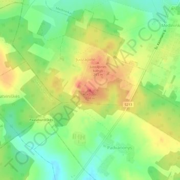
Nom : Carte topographique Aukštojas, altitude, relief.
Altitude moyenne : 264 m
Altitude minimum : 237 m
Altitude maximum : 291 m