
Carte topographique Firloch
Carte interactive
Cliquez sur la carte pour afficher l’altitude.
À propos de cette carte
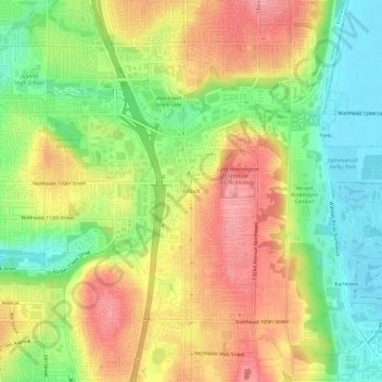
Nom : Carte topographique Firloch, altitude, relief.
Altitude moyenne : 59 m
Altitude minimum : 4 m
Altitude maximum : 115 m
Autres cartes topographiques
Cliquez sur une carte pour visualiser sa topographie, son altitude et son relief.
Finn Hill
United States > Washington > King County > Kirkland
Finn Hill, Kirkland, King County, Washington, 98034, United States
Altitude moyenne : 76 m
Inglewood
United States > Washington > King County > Kirkland
Inglewood, Kirkland, King County, Washington, 98028, United States
Altitude moyenne : 90 m
Kingsgate
United States > Washington > King County > Kirkland > Kingsgate
Kingsgate, Kirkland, King County, Washington, 98034-7114, United States
Altitude moyenne : 68 m