
Carte topographique Paktika Province
Carte interactive
Cliquez sur la carte pour afficher l’altitude.
Paktika Province
Paktika, like many other areas of Afghanistan, has been severely deforested. This has been a cause of devastating floods in recent years. The province is mainly hilly and interspersed with seasonal river valleys. In the north, the terrain gains elevation and becomes more rugged. In the west, the Rowd-e Lurah River originates in the mountainous Omna District and flows southwest to the Ghazni Province, forming a shallow river valley that dominates the topography in the Khairkot, Jani Khel, and Dila Districts. The terrain in Omna becomes more hilly further east in proximity to Pakistan. The sparsely populated southern districts are also hilly, with descending elevation towards the south and west.
À propos de cette carte
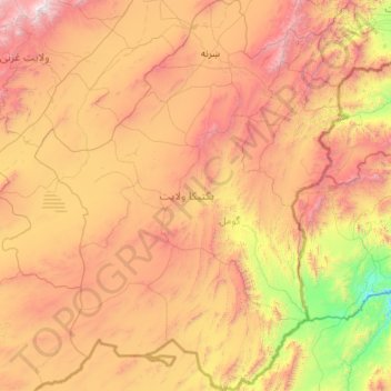
Nom : Carte topographique Paktika Province, altitude, relief.
Lieu : Paktika Province, Afghanistan (31.59340 67.81164 33.41721 69.54667)
Altitude moyenne : 2’109 m
Altitude minimum : 824 m
Altitude maximum : 4’273 m