
Carte topographique Bahador
Carte interactive
Cliquez sur la carte pour afficher l’altitude.
À propos de cette carte
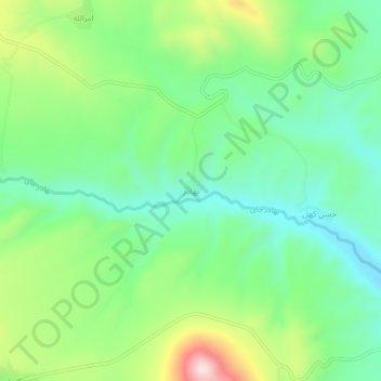
Nom : Carte topographique Bahador, altitude, relief.
Altitude moyenne : 2’108 m
Altitude minimum : 1’958 m
Altitude maximum : 2’417 m
Autres cartes topographiques
Cliquez sur une carte pour visualiser sa topographie, son altitude et son relief.
Sahand
Iran > East Azerbaijan Province > Bostanabad County > دهستان سهندآباد
Sahand, دهستان سهندآباد, بخش تیکمه داش, Bostanabad County, East Azerbaijan Province, Iran
Altitude moyenne : 3’118 m
Noshahr
Iran > East Azerbaijan Province > Bostanabad County > دهستان اوجان شرقی
Noshahr, دهستان اوجان شرقی, بخش تیکمه داش, Bostanabad County, East Azerbaijan Province, Iran
Altitude moyenne : 2’003 m