
Carte topographique Janapahad
Carte interactive
Cliquez sur la carte pour afficher l’altitude.
À propos de cette carte
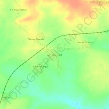
Nom : Carte topographique Janapahad, altitude, relief.
Lieu : Janapahad, Palakeedu mandal, Suryapet, Telangana, India (16.72475 79.70570 16.76475 79.74570)
Altitude moyenne : 77 m
Altitude minimum : 55 m
Altitude maximum : 98 m
Autres cartes topographiques
Cliquez sur une carte pour visualiser sa topographie, son altitude et son relief.
Dargah
India > Telangana > Palakeedu mandal
Dargah, Palakeedu mandal, Suryapet, Telangana, India
Altitude moyenne : 79 m